A Big Thank You to John McNamara!

Yes, I really do have a doctorate in computer science but often that just means I’m aware of how much I don’t know about computer programming. General Staff is being written in Microsoft WPF and sometimes it seems very arcane to me. I recently had a major problem with something very small; I just wanted to add a ‘thousands comma’ in the display of unit strengths. Well, because of a number of weird programming issues specific to WPF and the Victorian typography that we’re using, it took a couple of days to straighten it out and then only because John McNamara of Maine spent a great deal of his personal time to help me understand how Hierarchical Data Templates work in WPF. Here’s what the final results look like;

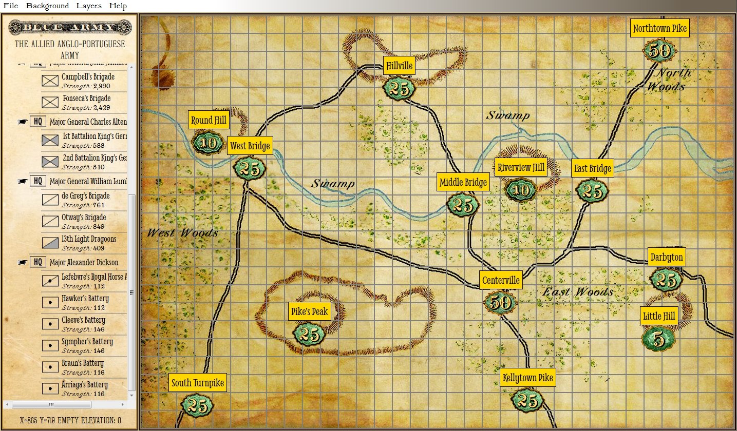
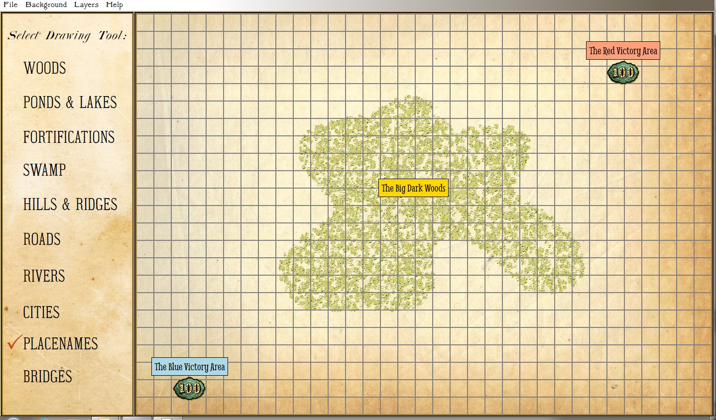
Sneak peak at the Scenario Editor Module. Just click and drag units from the Order of Battle Table on the left onto the map to place them for the beginning of the scenario. (Click to enlarge)

Again, thanks John! You’re the greatest! You want a free copy of General Staff when it ships?

Results of the Splash (Hachure) Contours vs. Concentric Elevation Contour Survey

The results of our survey to determine if you preferred splash (hachure) contours or concentric lines to represent elevation on General Staff maps are in: 58.21% voted for concentric contour lines and 41.79% voted for splash or hachure contour lines.

The results of our splash (hachure) contour lines versus concentric contour lines survey. 58.21% for concentric contour lines, 41.79% for splash contours.

However, while waiting for the results of the survey we wound up writing a splash (hachure) contour algorithm anyway:

An example of splash contours.

This isn’t perfect and we’ll continue to optimize it. However, General Staff will now include both methods of displaying elevation on a map: splash (hachure) and concentric elevation lines.

Help Us Decide: Splash Contours or Elevation Contours?

We need your input on how elevation (hills and ridges) will be displayed in General Staff. Originally we had planned on using ‘splash contours’. Splash contours were often used in quick sketch maps on the battlefield and they have an authentic look to them.

An example of a splash contour representing a hill (artwork by Ed Isenberg).

However, recently “Cry Havoc” – a Grognard on Facebook – asked if we were going to include the original Kriegsspiel Meckel map with General Staff. That got us thinking and taking another look at the original Kriegsspiel maps. Below is a map from the original American Kriegsspiel (circa 1892-8):

An original American Kriegsspiel map (circa 1892). Note the elevation contour lines. Click to enlarge.

Obviously, concentric elevation contours were in use in the 19th century so we could be authentic using either method of display.

This leads us to a very simple user survey:

[os-widget path=”/drezrasidran/splash-contours-or-concentric-elevation-contours” of=”drezrasidran” comments=”false”]

First Look at the Design Map GUI

This is just a quick screen capture to show what the interface (or Graphical User Interface, or GUI) is for the Design Map Module of General Staff. Simply click on the pallet on the left and draw on the map. You can also select from a number of weathered paper effects for a background.

Screen capture of the General Staff Map Design Module (click to enlarge).