
Last week I posted an appeal to the wargaming community and backers of The General Staff Wargaming System that I needed more maps and Orders of Battle (OOBs). The General Staff Wargaming System is designed to handle any conflict in the Black Powder era and the machine learning AI needs as much input as possible.
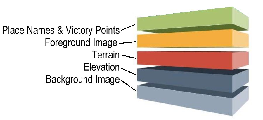
The five layers that make up a General Staff map.
The General Staff Army Editor makes it pretty easy to create four of the five layers of a map file (see above). The problem is the beautiful background image that the user sees on screen (the computer AI couldn’t care less about the visual map). I’ve been able to locate a lot of great maps; especially from the American Civil War and the US Library of Congress but we still need more.
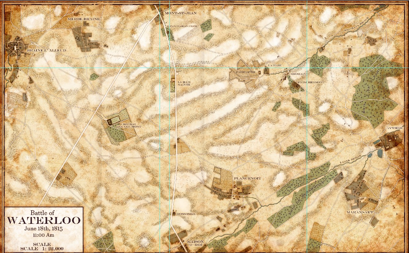
Waterloo from Glenn Drover (Forbidden Games) and Jared Blando. Click to enlarge.
A couple of days ago I received an email from the famous game designer, Glenn Drover (Forbidden Games), who offered us the use of three maps that he had researched and were drawn by artist Jared Blando. Here’s a link to Forbidden Games’ site. Please check out their fantastic board games!
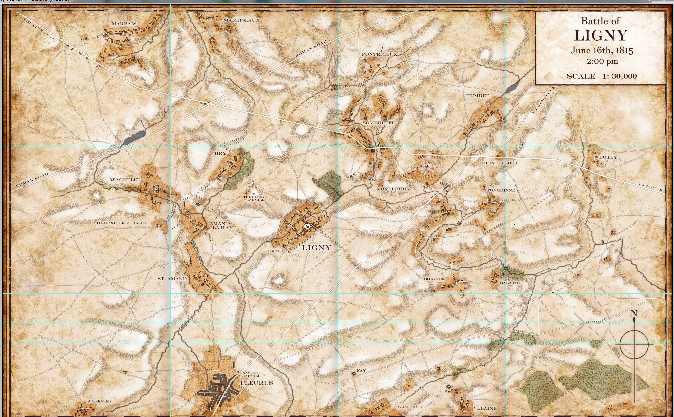
Ligny from Glenn Drover (Forbidden Games) and Jared Blando. Click to enlarge.
The three battlefield maps were Waterloo, Ligny and Quatre Bras.
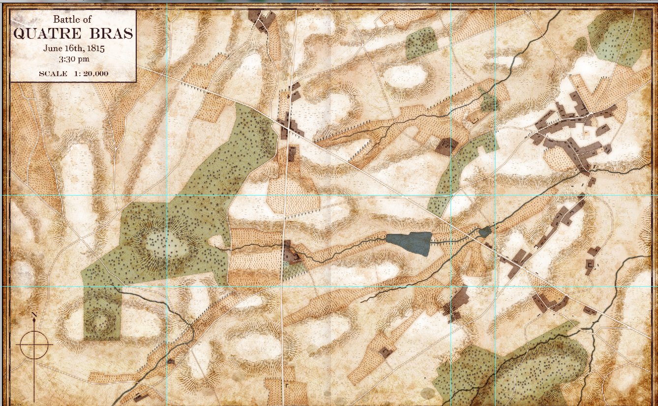
Quatre Bras from Glenn Drover (Forbidden Games) and Jared Blando. Click to enlarge.
What is especially amazing is how well these three maps fit the style that I’ve wanted to create for General Staff.
In addition to these three great maps, which we will definitely be using for the battles of Waterloo, Ligny and Quatre Bras, I’ve received emails from a number of other wargamers who have offered to research OOBs; especially some in another language.
I am completely blown away (I know it’s a cliche, but I don’t have any other words) by the kindness and generosity shown me by the wargaming community. Thank you very much!
The Waterloo map has many flaws. Mostly many of the hilly areas depicted actually did not exist on the battlefield. For example, the high ground next to the western edge of La Haye Sainte farm is ficticious – that area was a deep valley. Also, the extensive high ground ridge north-east of Plancenoit is inaccurate. In between Bois de Paris and Plancenoit there was a high ground area, but it turned into a valley just east of Plancenoit that ran north/south in between Smohaiin Stream down to the Lasne river. The highest ground ran from La Belle Alliance south past Le Caillou.
General Staff Wargaming System is a ‘sandbox’ where the user can change maps, unit information, weapon ranges and accuracy curves, etc., etc. We do our best research, or in the case of the Waterloo map, it was donated to us, but you, the user, can change literally thousands of variables however you wish. That is the strength of this system. We are not claiming to have the definitive answers. Indeed, numerous authors disagree about facts as basic as the effective range of a 12 lb Napoleon cannon. You, the user, can enter any value you wish.
Superb map making !
I would be glad to work on maps, but I still do not have the software,
You have posted this was released, how do I secure this?
I don’t know how I missed your comment. Please email me at Ezra @ RiverviewAI.com