Screen capture of General Staff showing the 3D Line of Sight (LOS) areas that are visible to the Red HQ unit (grayish areas are not visible). (Click to enlarge.)
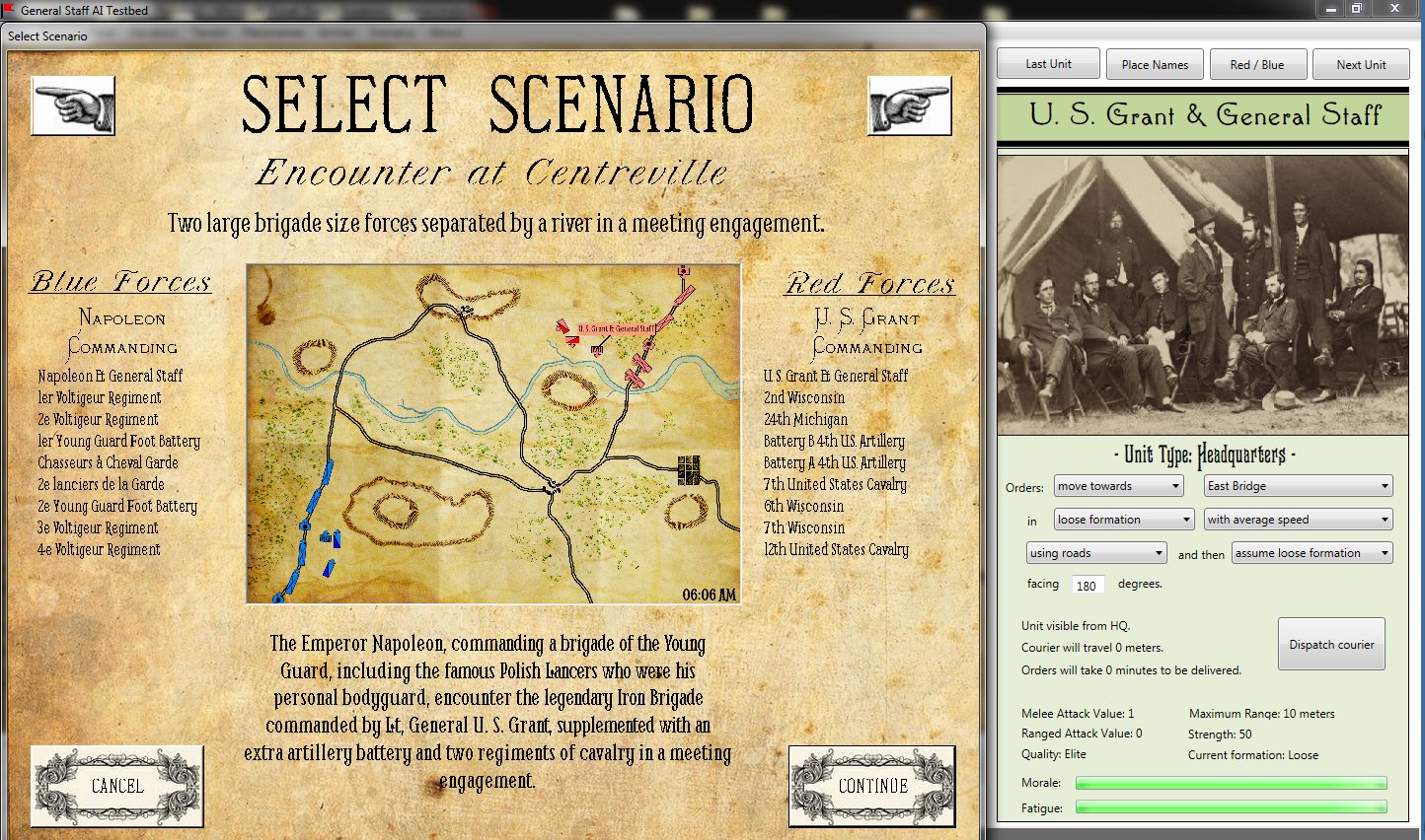
We are very pleased to show screen captures of General Staff that demonstrate some of its unique gamplay features. General Staff is different (at least as far as we know, and if there are other computer wargames that have these gameplay techniques, we haven’t seen them) in that you, the user, are assuming the role of the commanding general with his general staff. You do not have an omniscient view of the battlefield. The only unit locations (both friendly and OPFOR, or OPposition FORces) that you know for certain are the ones that you can directly observe. The above screen capture displays the areas that the Red HQ unit (U. S. Grant and staff) can see from their location on Riverview Hill. The 3D Line of Sight (3D LOS) algorithm in General Staff uses elevation and terrain maps to calculate the LOS for each unit.

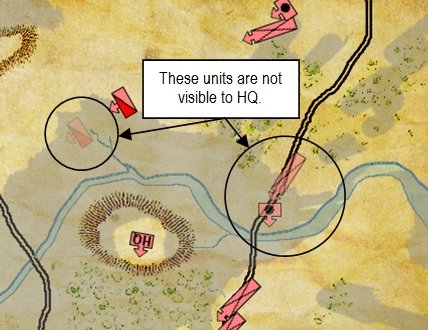
An example of how units that are not directly visible to HQ are displayed. The longer that a unit remains unobserved, the fainter it becomes. (Click to enlarge.)
When units are hidden from direct LOS they begin to fade (as seen in the screen capture to the right). The longer it has been since the unit has been observed, the fainter the unit is drawn. However, every hour, every friendly unit dispatches a courier to headquarters with its current unit location. When the courier arrives (his path is calculated and described below) the unit’s position is updated and the unit is displayed in full color. In the above screen capture, arriving messenger reports are displayed in the bottom of the screen. Enemy units, however, that have not been observed for an hour disappear completely from the map.

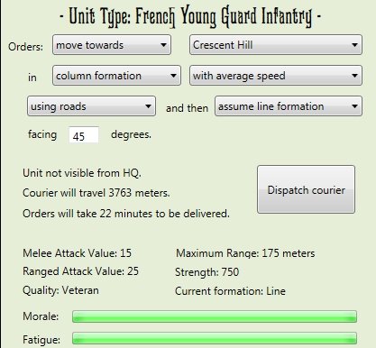
Screen capture showing easy to use interface for giving orders. Also displays unit information, distance from HQ, morale and fatigue. (Click to enlarge.)
Orders are not given directly to units, as in other wargames, but are sent, via courier, from HQ to the unit. The screen capture (right) shows the interface for constructing a unit’s orders. Orders are entered via unit-specific pop-up menus that specify the formation, direction, facing and speed for the unit. Also displayed is how far the messenger will travel and how long it will take for to deliver the orders. Couriers travel at 17.5 kilometers per hour and will attempt to use roads whenever possible.
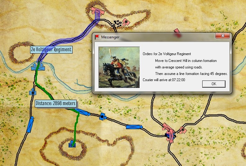
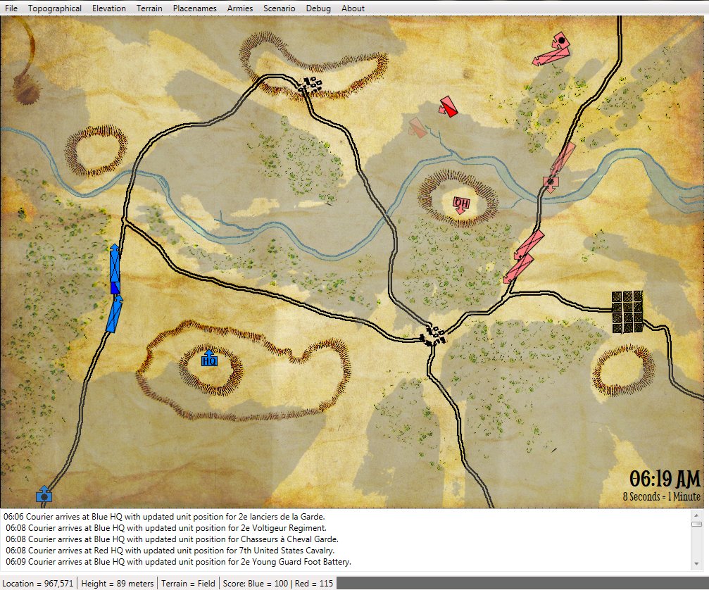
This screen capture displays the path from Blue HQ to the unit that the courier will travel (in green), the future orders for the unit (thicker blue) and confirmation of the orders. Note how the courier automatically takes advantage of roads. (Click to enlarge.)
The above screen capture shows the path the messenger will take (in green), the orders (in transparent blue) and a confirmation pop-up that shows the time the messenger will arrive at the unit with the new orders.
We have since updated the Messenger box to look like this (in keeping with the 19th century late Victorian theme of General Staff):
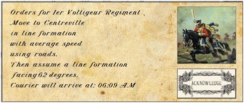
A screen capture of the new Messenger information box.
We believe that this structure not only is an authentic depiction of warfare in the 19th century and how the generals experienced ‘fog of war’, but will greatly enhance the gameplay of General Staff.